|
|||||
|
|
|
|
|
Register in person (Registration form, waiver) | return to terraloco home
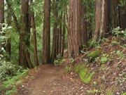
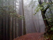
Ah, to run in a redwood forest. Although a tad "chill" during the event, conditions were quite good for moving around. I preran the course I set on paper and the map and course held, but the statistics did not pay due homage to the physicality of the course. What I thought was the ideal route actually turned out to be not quite ideal because of a deep canyon bisecting the map, so the actual point to point distance was 5.84 km to get all 9 checkpoints set. Tapio's track GPS track measured 10.26 km, although he thinks his route wasn't quite optimal. And it took me 86 minutes to go to all 9 at a reasonable pace; I probably spent 5 to 10 minutes total thinking of questions and answers since we weren't allowed to place bags. So, it was pretty steep, especially to get the remote checkpoint near the archery range - which isn't too far from Skyline Blvd.
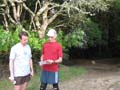
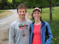
Nonetheless, Will Gilmore and Tapio Karras were able to get them all with the limited daylight. And everybody grabbed a bunch. I wasn't able to gather any consensus on what was the best order to get them all. I think I had a good order, but it might not be optimal. Because of the steepness, careful planning was necessary. Also, it wasn't always easy to follow the trails and stay on course, as some participants found. Some interesting training, and those fabulous redwoods. I enjoyed setting this up.
Results - get any 3 checkpoints
Melissa & Dennis Wilkinson 93:24 (got 4 checkpoints)
Results - get any 6 checkpoints
Joe Knapp 67:10
Steve Haas 93:30
Joseph McGinley & Gwen Juha 102:36 (got 8 checkpoints)
time not recorded: Tim Kuenster & Stephanie Rowan
Results - get any 9 checkpoints
Will Gilmore 91:36
Tapio Karras 91:52
Original Announcement
|
|
|
|
|
What's the Deal?
The magical redwoods of Huddart beckon... enjoy a fun score course on the trails! You can get the checkpoints in any order. Ten "virtual" checkpoints will be used - I will use photographs or question and answer clues for each. Categories? Get 10, 7, or 4 of the checkpoints. Those checkpoints were picked very carefully. Interesting route planning strategies are required. To get all 10, it's 5.6 km about as the crow flies, but remember, Huddart is steep, and the routes will usually not be straight - think 5.6 miles! To get 7, it's about 3.5 km as the crow flies.
Details
Starts are only available until 6:15! That will be the group start option. The ranger has asked us that we be done by 7:15. I will be set up by 5:00 if you'd like to get an early start. Cost is $5 / person. A social option will be available afterwards.
Directions:
It's $5 per car to enter Huddart Park. Consider carpooling from the Park 'n Ride lot at Highway 280 and Woodside Road.
When coming to Huddart from the north (San Francisco) or the south (San Jose), use Highway 280. Turn off at the Woodside Road (Highway 84) exit. Turn westbound (towards Woodside). Proceed approximately 1.5 miles through the Town of Woodside. Turn right on Kings Mountain Road. Proceed up the hill to the main park entrance.
After entering the park, park at the edge of the first big meadow nearest the entrance station. Start and finish will be in the meadow.
Event Contact: Rex, 5 1 0 - 6 8 1 - 6 1 8 1, rex@terraloco.com